
The Survivability Map
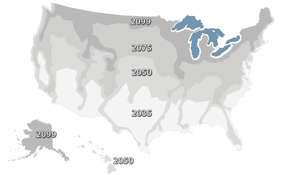
The Survivability Map is based on a myriad of assumptions, research dead ends, mash-ups of literally dozens of national maps, and a sprinkle of imagination. Assuming we will reach 4°C by 2099, the Survivability Map identifies areas that will no longer be habitable and those most likely to support millions of people as they migrate in search of cooler temperatures, fresh water, and reliable food sources. It really is that simple. It’s time for us to design and build a survivable future.
The Bad News
- Drought is the biggest threat. The Ogallala Aquifer in the heartland is going dry. The Colorado River, which provides water and power, is drying up.
- Wet-bulb temperature events will make the southeast U.S. unbearable.
- Forest fires across the country will continue to increase in both frequency and severity.
- Sea level rise is less of a threat than many think. Even at 10 feet, or 3 meters of coastal flooding, most cities will still be functional.
The Good News
- The Great Lakes Region offers enough space for 1 billion people to resettle. The lakes not only provide drinking water and irrigation, but they can also provide cooling.
- The Rocky Mountains offer access to water and cooler temperatures
- The Pacific Northwest offers access to water and cooler temperatures and serves as a gateway to Alaska
- Alaska has enough space for 500 million climate refugees to resettle by 2099.
Want to learn more? Join the Survivability Community by opting in to the email list below or following us on social media.